BELKNAP SEQUOIAS CUT-OFF
| Season: | April through November |
| Distance: | 1 1/2 miles to the junction |
| Elevation: | Trail head – 5,000 feet
Bear Ridge Junction – 6,000 feet Gain – 1,000 feet |
| Difficulty: | UP, Difficult – 2 hours
Down, Moderate – 3/4 hour |
| Drinking water: | Usually reliable spring by fallen giants, east of trail |
This unsigned (31E23) trail starts in the McIntyre Tract adjacent to the Lasswell cabin which is the 5th cabin upstream from Belknap Campground. The trailhead is alongside the remains of an abandoned fence, which you can find by close scrutiny of the area. It goes up several switchbacks at slopes in excess of 30% and passes one vista point with a view of Camp Nelson to the west.
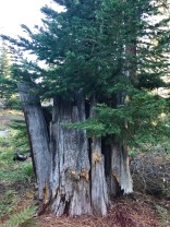
After slightly less than a mile the trail peters out and the terrain levels off. You are now in the lower half of the Belknap Camp Grove of Sequoias. There are several recent (1983) giant windfalls here and the gently slopes of the area make it a fine picnic spot. Two of the giants are almost at right angles to one another and a spring is located within their embrace perhaps 150 feet from the corner intersection. Out of the bark of these fallen goliaths, which make wonderful scenic rest stops, sprout many young firs, pines and even Sequoias.
The trail through the grove is very hard to find, but is marked by piles of rocks (“ducks”) and by pairs of aluminum rounds mailed to trees. To follow the trail, you must travel between markers such that the next one is always visible from the last marked tree. When you have difficulty, put your back to the tree just under the marks on the opposite side of the marks you just hiked to. Do not process until the next trail marker is in view. Should you go ahead and get lost anyway, proceed up-slope to the top of the ridge (about 1/2 mile, but it will seem like 5 or 10) where you will meet the fairly well maintained COY FLAT – BEAR RIDGE TRAIL (31E31).
If you are still on the trail you will come to a “Y” where you can take the left trail on up to the upper half of the Sequoia grove, where you will pass several really large trees. The right branch will take you to Coy Flat. The “Y” is identified by a cluster of four aluminum rounds, rather than the two which customarily mark this trail.


