JORDAN PEAK LOOKOUT
| Season: | Mid-June through October |
| Distance: | 2 1/2 miles, round trip |
| Elevation: | Trail head – 8,500 feet
Jordan Peak – 9,100 feet Gain – 600 feet |
| Difficulty: | Easy – 2 hours |
| Drinking water: | Spring north side of road 20S71 |
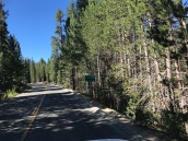
Take the North Road (21S50) from Quaking Aspen. It leaves Highway 190 about 1/4 mile west of the entrance to the Quaking Aspen Campground. The North Road is well signed and is well-paved for the first 5.5 miles to the junction with road 20S79, which goes to the Golden Trout Wilderness Pack Station. Take the left fork (20S50) for another 2.0 miles. Road 20S71 bears to the left here and is usually signed “Jordan Peak Lookout”. The signed trail head is at the cul-de-sac at the end of the narrow dirt road. This excellent trail is voluntarily maintained by Jeffery Lantz.
It is steep but short, a scant mile leading through a partially logged red fir forest. At the summit, you are treated to an excellent view of Camp Nelson, Slate Mountain, Sequoia Crest, Moses (the rocky ridge) and Maggie (the nicely shaped peaks) Mountains, the higher mountains near Mineral King and in the distance, above the valley smog, the Tehachapi’s and the Coast Range.
Microwave equipment covers the tower for communicating with headquarters and for relaying messages into the Kern River and Kern plateau. Power is provided by large arrays of solar cells.
Please respect the privacy of the lookout. If the lookout is not busy, you may be invited up the tower for a superb view.
To return to your car, take the trail leading down to the OLD JOHN JORDAN TRAIL. Go down about 1/2 mile until you come to a signed trail and abandoned logging road (the remains of 20S71) bearing off to your left. The Jordan Trail and McIntyre Rock are about 1/2 mile further on. Follow this abandoned road about a mile back to your car at the cul-de-sac.


