WINDY GAP – SLATE MOUNTAIN TRAIL
| Season: | Mid-June through October |
| Distance: | 4 1/2 miles to the junction |
| Elevation: | Trail head – 7,550 feet
Junction – 9,050 feet Gain – 1,500 feet |
| Difficulty: | Moderate – 3 hours |
| Drinking water: | Creek south end and spring at Freezeout |
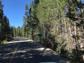
Drive to the well signed trail head at Windy Gap either by going south on the Great Western Divide Highway 6.4 miles and then 3 miles up the Crawford Road or by going to the north end of the Crawford Road (21S94) at Rogers Camp, about 4 miles south of Coy Flat on mountain road 192A (20S94) and then further south about 10 or 12 miles on the Crawford Road. You can’t miss it.
The Summit Trail is (31E14) heads north from there and for the first 3/4 miles it gently rises a hundred feet or so through well-watered fir and Jeffrey pine. For the next 1 1/4 mile you climb 800 feet in earnest. It is a fairly steady 15% grade. Presently you crest the ridge. Take the trail to the north. There is a trail to the south, but it only goes to a vista point 1/2 mile or so away. The point overlooks Kern Canyon nearly a mile below.
One mile past the junction you will pass Freezeout Meadow on your right where there is a spring alongside an old deer hunting campsite. It is a little way off the trail and down hill so is not a good candidate for filing your canteen. The trail from here north undulates through old growth red fir forests along the Great Western Divide which separates the Tule and Kern Rive drainages. Many vista points (you have to find them, they are unsigned) provide opportunities for good views of the Tule River Indian Reservation, the valley and Coast Ranges beyond. The views are typical “California”, thought the vantage points are rare.
After passing the 9,302 foot peak of Slate Mountain off to your right (it is that jumbled pile of granite boulders) you will have traveled about 4 1/2 miles from the trail head and will be at the junction of the Summit Trail (21E14) and the Bear Ridge Trail (31E31). The trail to the right goes 4 miles to Quaking Aspen Meadows. The one to the left goes 7 miles to Coy Flat or 6 miles to Belknap Campground. (See QUAKING ASPEN – SLATE MOUNTAIN TRAIL & SLATE MOUNTAIN – BEAR RIDGE TRAIL)


