COY FLAT – BEAR RIDGE
| Season: | Mid April through October |
| Distance: | 3 1/2 miles to top of the grove |
| Elevation: | Trail head – 4,600 feet
Top of grove – 6,500 feet Gain – 1,900 feet |
| Difficulty: | Up – Moderate, 3 hours
Down – Easy, 2 hours |
| Drinking water: | Very unreliable spring at the top |
This trail is the authors’ favorite. It is a steady climb, ending in a beautiful redwood grove, at the very top of which is a spring and a dry handing meadow surrounded by pillars of large Sequoias.
From Camp Nelson, drive down Coy Flat Drive, across the Tule River and through the Coy Flat Tract. On your right, about 1/4 mile beyond the last cabin, there is a parking area about 100 feet before Bear Creek. The well signed trail head (31E31) is across the road. The trail heads uphill and switches back to an old logging road, by-passing a 1983 slide that destroyed part of the old trail. About 1/2 mile from the trail head, you pass the Coy Flat water tank on your left. Shortly the trail switches back to the right. Be sure to notice the huge Manzanita bush under which the trail passes. You can easily ridge a horse under it without losing your hat. A couple of hundred yards further on you reach the Bear Creek side of the ridge, and are greeted with a beautiful view of Slate Mountain and Rogers Camp. The forest has changed from fir-cider-ponderosa to golden oak-manzanita-buck brush with a profusion of wild flowers. This south facing slope is quite hot in the summer.
After a half mile on this south face. the trail switches back to the left and up to the sugar pine forest a the top of the ridge, 1 1/2 miles from the trail head. A side trip to a vista point is in order here. To gain a panoramic view of Camp Nelson and Pierpoint Springs Resorts, hang a left and go west along the level ridge for about a hundred yards. It is a good picnic spot, offering both sun and shade as well as the view.
The trail follows the crest of the ridge easterly for about 3/4 mile. Presently you will come to one the two poorly defined trails (31E23) which bear off northerly to the left and down slope through the lower Belknap Camp Sequoia Grove to the Belknap Campground. These trails are described in BELKNAP SEQUOIAS CUT-OFF TRAIL.
Continuing on the Bear Ridge Trail you follow the north side of the ridge for another 1/4 mile before entering the upper half of the Belknap Camp Sequoia Grove. The Kathryn Tree is the large one on the left which lost a 6 by 8 foot limb from the crown during the winter of 89-90. You are now about three miles from the trail head. Dogwoods are on your left and then you pass the Patriarch (Matriarch ?) Tree with his 14 daughters to your right before gaining the ridge at the “X” tree, at the foot of which grows a carpet of “elegant cat’s ears” in the spring.
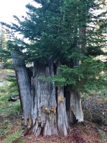
If the trail disappears, stay reasonably close to the crest of the ridge and head straight up. You will find the trail near the top of the slope. After passing the “corkscrew tree” there is a pretty little dry meadow at the tope of the grove which is surrounded by some large Sequoias with remarkably smooth bark – no furrows at all! It is a delightful picnic area. The unreliable spring is about 100 yards above the meadow behind a log below the trail.


