SLATE MOUNTAIN – BEAR RIDGE
| Season: | July to October |
| Distance: | 3 1/2 miles to top of the grove |
| Elevation: | Junction – 9,050 feet
Top of the Grove – 6,500 feet Loss – 2,550 feet |
| Difficulty: | Down – moderate, 2 hours
Up – difficult, 3/4 hours |
| Drinking Water: | Spring 1 mile north of junction |
The Summit Trail head (31E14) and the first portion of the hike up to the junction of the Bear Ridge Trail (31E31) are described in QUAKING ASPEN – SLATE MOUNTAIN TRIAL or WINDY GAP – SLATE MOUNTAIN TRAIL.
The Slate Mountain summit is south and the Bear Creek Trail bears off to the north. It is not marked and frequently is hard to follow. When in doubt, look for blazes on trees and piles of rocks (“ducks”). Follow the trail down the ridge and keep looking for clues as to its location.
A little less than a mile from the junction, the trail reaches a broad saddle where it curves east into a bowl and then turns north and passes west of a spring-fed pond in Lost Meadow near the base of the bowl. Shortly you will come to Little Pack Saddle Meadow where there are a couple of rustic camp sites near an excellent spring, the effluent of which flows along the surface for a short distance before again sinking into the ground. It does not usually cross the trail. You are exactly one mile from the junction.
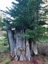
There is a “Bonzai” forest of pines and firs across the meadow at the crest of the ridge. The dwarf trees struggle to survive on the wind-swept rocky sand. Some of the firs grow only about six feet high, yet are so old as to have cones on their uppermost branches. Cross-country hiking west around Nelson Peak (trail 31E33, if you can find it) will get you to Rogers Camp and MountainAire.
Continue on down the trail which is easy to lose – but then you really have not lost much. Stay on the ridge because for the next half mile there are some spectacular views of the Nelson valley from the rocks west of the trail. After another 3/4 miles the chinquapin gets thick and the trail skirts around to the right under it. Then you pass some rocks and then the trail regains the ridge about a half mile from the chinquapin detour.
The trail leaves the ridge a little more than 3 miles from the junction and goes westerly across a small drainage before mounting a second ridge trending north-northwest. Presently you come to a dry meadow at the top of the Belknap Camp Grove of Sequoias, 3 1/2 miles from the junction. The trail from here down is covered in the COY FLAT – BEAR RIDGE TRAIL.


