OLD JOHN JORDAN TRAIL
| Season: | Mid-June through October |
| Distance: | 3 miles, one way |
| Elevation: | Upper trail head – 8,000 feet
Lower trail head – 6,720 feet Loss – 1,280 feet |
| Difficulty: | Down: Easy – 2 hours
Up: Moderate – 4 hours |
| Water: | Small creeks at either end |
This historic trail (31E24) is a segment of one of the pioneer routes across the central Sierra. John Jordan was rancher down in the Yokohl Valley when gold was discovered in the Kern Canyon and out in the desert near Aurora and Bodie. He laid out the route and secured a permit to build a toll road across the mountains to the mining camps. He and his sons built this trail which went all the way across to Lone Pine, past Jordan Hot Springs (named in his honor). Tragedy struck at the Kern River crossing, where he drowned. His toll road was never completed.
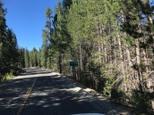
Take the North Road (21S50) from Highway 190 just west of Quaking Aspen Meadows (See JORDAN PEAK TRAIL). After passing the pack station road (20S79), bearing off to your right, a further 1.1 miles brings you to a gated road bearing off to the left. Take this road (20S81) for 1.4 miles. You will pass Osa Meadow where the road crosses the Summit Trail (31E14). (Near this crossing are the remains of the old McIntyre Trail which led from Junction Meadow steeply down to Camp Nelson. It crossed Highway 190 between McIntyre Creek and Cedar Slope and ended in the McIntyre Tract just up from the Belknap Campground.) The trail head is well signed and the trail is voluntarily maintained by Jeffery Lantz. The actual foot path is somewhat difficult to find, but it is marked by a pile of “ducks” on the left side of the road. Don’t go too far because the trail bears off to the left through a primitive campground and crosses the headwaters of McIntyre Creek.
After crossing the creek the trial is easy to follow. You soon cross the saddle between Jordan Peak and the site of Pacific Telesys microwave relay station which serves this part of the world. Keep your eyes peeled along the trail for tree blazes.
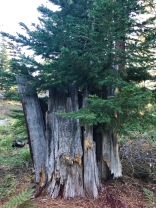
The rectangles were chopped over 50 years ago by the CCC crews out of Springville, If you are fortunate, you will find the vestiges of John Jordan’s original blazes, which were equilateral triangles. The trail is fairly level for the first mile or so until you come to an abandoned drift fence and gate. The gate is adjacent to McIntyre Rock which is the large granite outcropping so prominently visible from Camp Nelson. It is worth a stop for a rest at this vista point stop the rock.
At the gate another signed trail switches-back up-slope a mile to Jordan Peak, the lookout of which provides another memorable vista (See JORDAN PEAK TRAIL). The next mile takes you on a steady decline through a mature red fir forest to the headwaters of Nelson Creek where you start seeing pines and the signs of logging activity. A half mile further brings you to the end of this trail segment at a logging road spur leading off east form Redwood Drive, 1.1 miles from Sequoia Crest.
If you are starting the trail here, you must first take the logging road for about 3/4 mile to the sign which reads “Main Trail” and then follow the trail or the road for another quarter mile to the trail head sign which announces Jordan Peak Lookout.
The old trail continued down past Hossack Meadow (the original site of the summer headquarters of Sequoia National Forest – can you believe it?) and on down to Camp Wishon where it again rose up over the flank of Moses Mountain before dropping down into Yokohl Valley and on into Visalia. This route was chosen to avoid the 12,000 foot heights of Mineral King.


