Ponderosa circled in yellow.
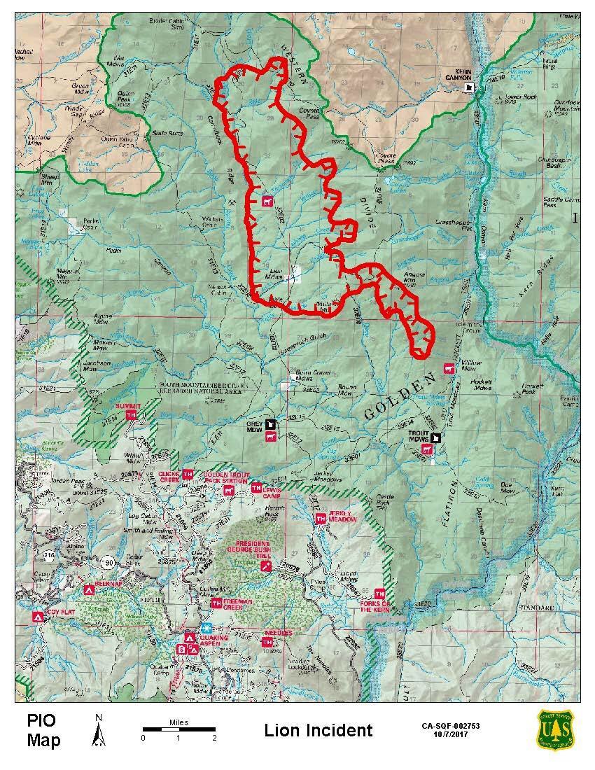
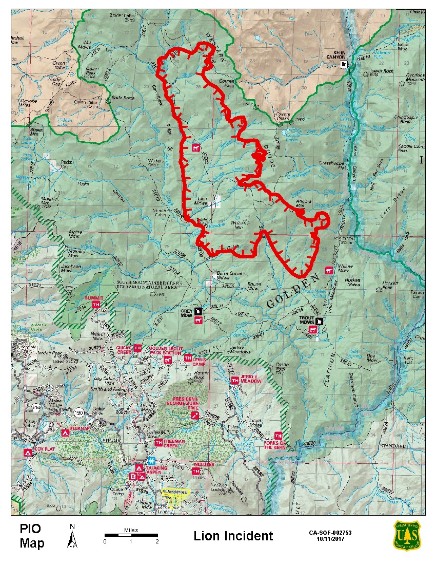
As of today, October 14, 2017, the Lion Fire has grown to 16,250 acres, an increase of 800 acres. Fire managers yesterday observed good fire behavior and effects, the need to complete firing operations was not necessary to bolster control lines. Allowing the fire to progress naturally by backing toward trail 32E02 and the southern control line.
The fire continues to back down the southeast face of White Mountain and southwest face of Angora Mountain towards trail 32E02, a trail that is being used to slow down the progression of the fire till it reaches the southern control line.
Incident Commanders continue to work with the San Joaquin Valley Air Pollution Control District (SJVAPCD) for firing operation approval, while wildland fire suppression operations are taking place to continue to keep up with the fire. One hotshot crew is preparing for a planned defensive firing operation today on 32E02 trail from the Fish fire scar to Burnt Corral Meadow, and firefighters have scouted trails near the Kern River Drainage, in case the fire moves towards the river. Crews remain engaged in prepping the southern control lines by reducing fuels and finishing line construction around private property and cultural values. In addition, prep continues on the southern control lines – summit trail and the north rd.
Today at 0600, Sequoia National Forest Type 3 Incident Command under IC James Robertson transitioned to Sequoia National Forest Type 3 Incident Command under IC Ernie Villa.
Smoke Impacts:
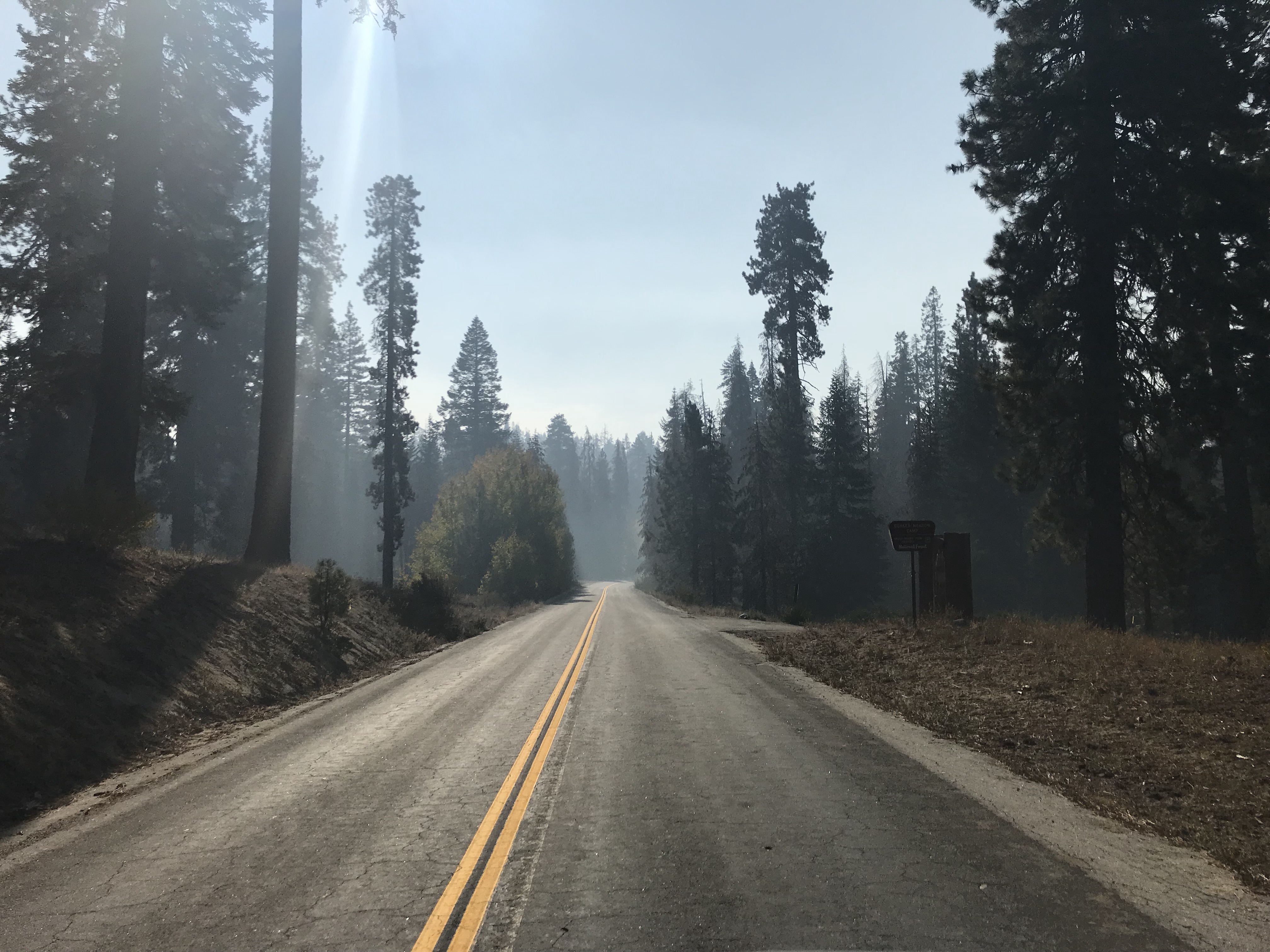
As high pressure moves in from the south, smoke will begin a westward push. This should decrease the impacts to the eastern Sierra area this weekend, but bring some impacts towards communities near the foothills from Three Rivers and Visalia south to Springville and Porterville tonight into Sunday. Some residual smoke from the northern California fires gradually is dispersing in the San Joaquin Valley, although generation north of the Bay Area continues. You can learn more about air quality, and daily smoke forecasts are available visiting either http://www.airnow.gov or http://www.valleyair.org. Lion Fire visit https://inciweb.nwcg.gov/incident/5626/
Basic Information
Current as of 10/14/2017, 9:24:02 AM
Incident Type Wildfire
Cause Lightning
Date of Origin Sunday September 24th, 2017 approx. 05:00 PM
Location Near Lion Meadow in the Golden Trout Wilderness, Sequoia National Forest
Incident Commander Ernie Villa USFS
Current Situation
Total Personnel 150
Size 16,250 Acres
Estimated Containment Date Monday November 27th, 2017 approx. 12:00 AM
Fuels Involved
Timber litter and understory, 2-ft tall brush, and 1-ft tall grass. Pine needles and timber litter
Outlook
Planned Actions
Incident Commanders continue to work with the SJVAPCD for firing operation approval, while wildland fire suppression operations are taking place to continue to keep up with the fire. One hotshot crew is preparing for a planned defensive firing operation today on 32E02 trail from the Fish fire scar to Burnt Corral Mdw, and firefighters have scouted trails near the Kern River Drainage, in case the fire moves towards the river. Crews remain engaged in prepping the southern control lines by reducing fuels and finishing line construction around private property and cultural values. In addition, prep continues on the southern control lines – summit trail and the north rd.
Remarks
Forest Closure Order
0513-17-40
, has closed trails in the Golden Trout Wilderness northeast of Grey Meadow, northwest of Trout Meadow, east of Nelson Cabin, and south of the Park boundary.
Jerky Meadow and Summit Trails which encompasses the southern and western areas of the control lines were added to the closure area Oct. 12, 2017.
Current Weather
Weather Concerns
As high pressure moves in from the south, smoke will begin a westward push. This should decrease the impacts to the eastern Sierra area this weekend, but bring some impacts towards communities near the foothills from Three Rivers and Visalia south to Springville and Porterville tonight into Sunday. Some residual smoke from the northern California fires gradually is dispersing in the San Joaquin Valley, although generation north of the Bay Area continues. Sky/weather…Sunny
Max Temperature…56-59
Min Humidity…28-31%
Eye Level Winds…Downslope/down canyon 2-4 mph in the morning shifting to upslope/up canyon 4-6 mph after 1200 PDT.
Surrounding Ridge…West to northwest 3-6 mph in the morning increasing to 8-13 mph with gust to 20 mph by afternoon.
Mixing height… Less than 500ft AGL in the morning, rising to 5000ft AGL by afternoon Transport winds…Northwest around 9 mph