
****please see new post for updated info as of 830am, 9/3/17****
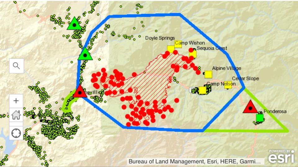
13000 acres, zero containment.
Green dots are homes.
Blue line is the mandatory evac area.
Green lines are voluntary evac areas.
Squares are cities.
Triangles are road closures.
Red dots represent active fire, which includes controlled backfires that crews are setting to burn fuel ahead of the fire.
#Pierfire


Guess the hot weather makes it impossible
LikeLike
PLEASE pray for our firefighters.
LikeLike