
***please see updated info as of 930pm, 9/3/17***
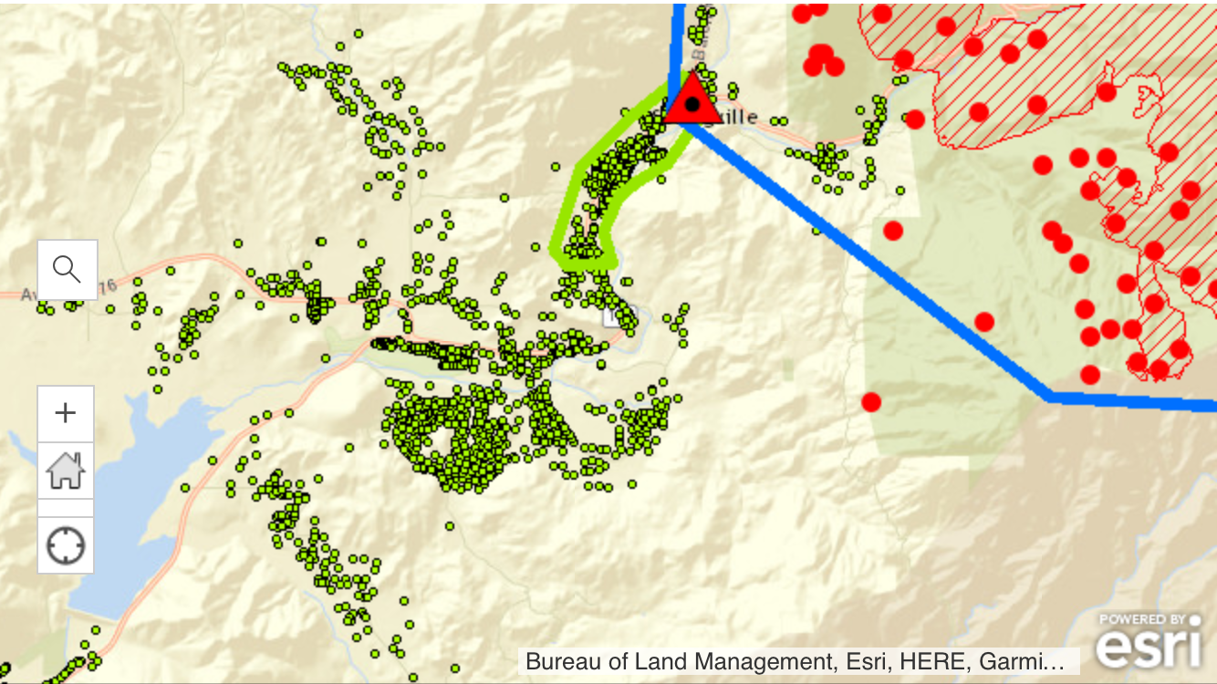
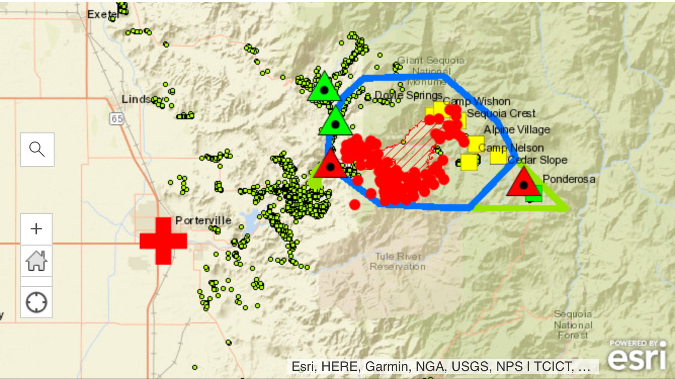
17,418 acres, zero containment.
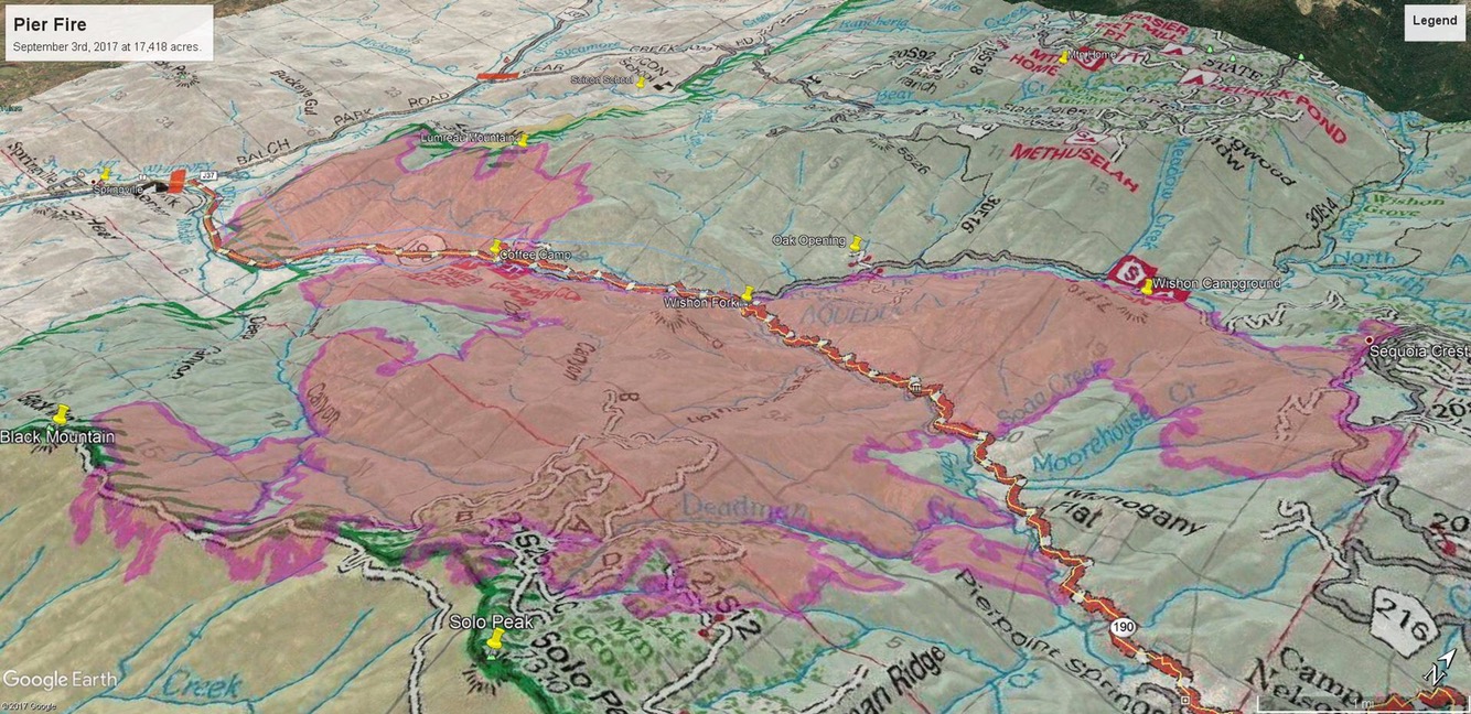
One map shows the whole area, the others show zoomed in versions to show detail.
There appears to be substantial growth from last night.
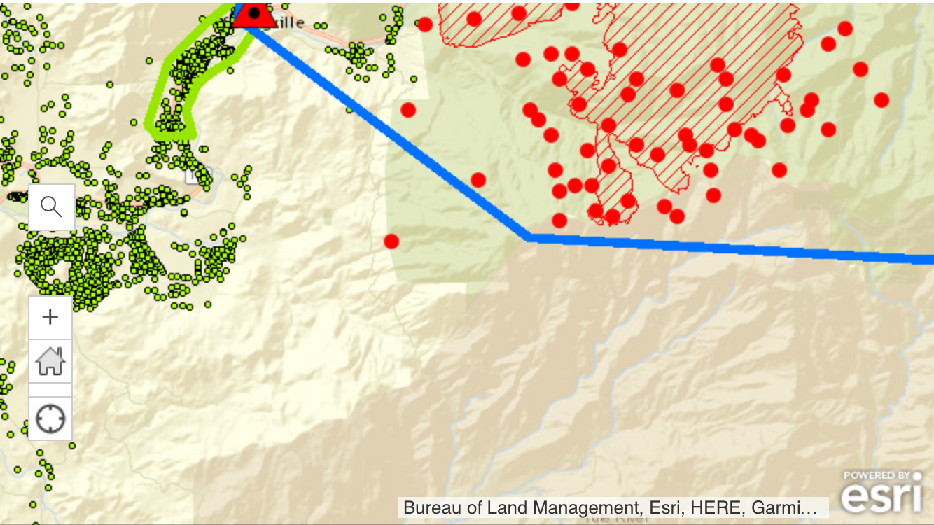
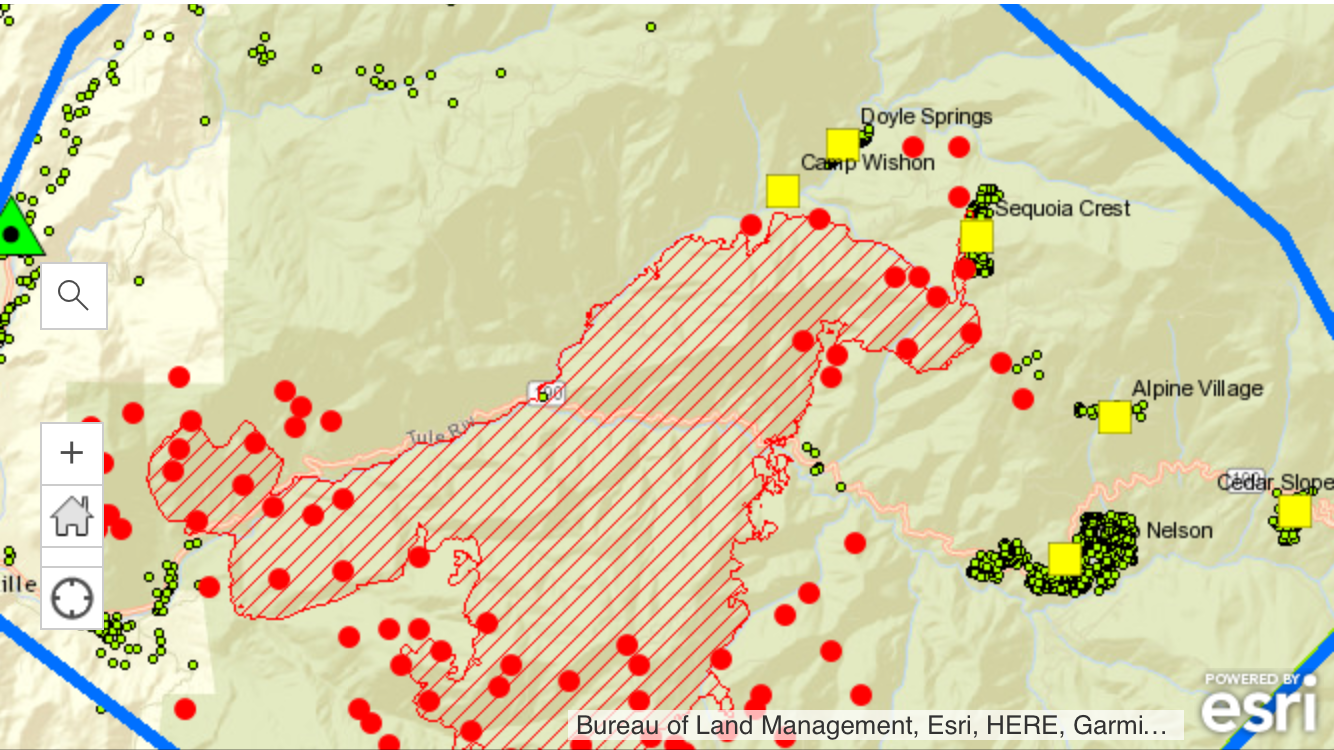
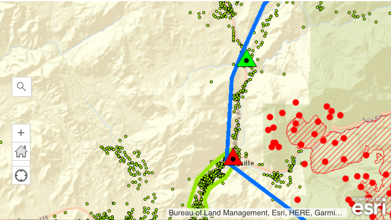
Green dots are homes.
Blue line is the mandatory evac area.
Green lines are voluntary evac areas.
Squares are cities.
Triangles are road closures.
Red dots represent active fire, which includes controlled backfires that crews are setting to burn fuel ahead of the fire.


Pingback: Pier Fire Current Map | Ponderosa, Ca
I feel so bad for everyone. The fire fighters must be exhausted. God Bless Their Souls 🙏🏻
LikeLike